
Environmental Public Health Tracking (EPHT)
Environmental Public Health Tracking (EPHT) is a tool to help Arizonans learn about environmental hazards in the state that could impact their health.

Health, Child Care, and Radiation Control Facilities
Interactive map of Arizona health, child care, and radiation control facilities.

Does My Child Need a Blood Test?
Interactive map used to determine if your child needs a blood lead test based on risk factors in your neighborhood.

Community Profiles Dashboard
Interactive dashboard used to visualize public health statistics by County and Community.

Certificates of Necessity
Interactive map of all ambulance service areas in Arizona.

Mapping the Opioid Epidemic
Maps of opioid overdoses and deaths by Primary Care Area (PCA).

Dump the Drugs AZ
Locate and get directions to the nearest site to safely dispose of unwanted prescription drugs.

AZ Food Access
Interactive map showing areas with low access to quality food sources and the location of food providers.
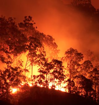
Active Wildfires & Critical Healthcare Facilities
Developed for emergency management professionals to provide situational awareness of critical health facilities potentially impacted by wildfires.

Sliding Fee Schedule Clinics
Find clinics in Arizona that provide free or low cost services to people who don't have health insurance.

Medical Marijuana Dispensaries - Map Your CHAA
Enter your address to determine which CHAA (Community Health Analysis Area) you are in and how many Medical Marijuana Dispensaries are in that CHAA.

AZ Hospital Compare
Interactive dashboard used to visualize and compare hospital level public health statistics by indicator.